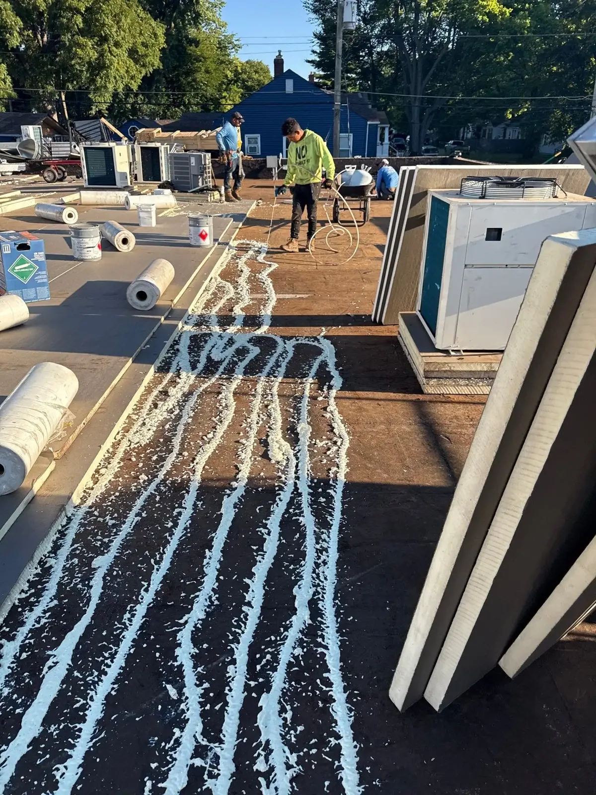
An aerial image can show a pattern that is hard to see from a hatch or ladder. We use drone imaging to survey large commercial roof areas, document visible surface conditions, and direct the next hands-on checks. In Springfield, a property with multiple additions or equipment zones may need an overview before the inspector selects a safe route. On an industrial parcel like the Smith & Wesson site off Roosevelt Avenue, an overview sorts a large site into roof zones before anyone walks it. In the East Springfield area, the overview can help relate a roof section to a loading or equipment zone before we approach the edge.
Plan the flight
Before flight, we confirm property permission, airspace, weather, launch location, flight path, and people or vehicles near the work area. The plan should not send a drone over an active public entrance or exposed work crew. Wind, precipitation, glare, and poor visibility may limit the images that can be collected. We choose a flight height and angle that show roof sections without creating a false sense of detail. The output is an overview, not a substitute for a close-up test of a seam or flashing.
The Springfield Medical District includes a range of institutional and health-service uses in its documented inventory. At an occupied medical property, flight timing and the area below must be coordinated with the facility contact. We keep the launch zone clear and avoid recording people or sensitive operations. A Medical District roof survey can be planned around safe access and site rules. The flight log records the area covered, any gaps, and conditions that affected image quality.
Read the surface pattern
Images can help locate ponding, debris, surface discoloration, displaced objects, and visible membrane or metal changes. A comparison between roof sections may show where water appears to remain or where a patch interrupts the surrounding surface. Those features guide an inspector toward a closer review. They do not confirm that insulation is wet, that a seam has failed, or that a roof needs replacement. We pair image review with field observations, drawings, leak history, and test methods that answer the specific question.
Springfield’s State Street corridor includes businesses, residences, institutions, parks, and historic assets. A building within that varied setting may have occupied areas or limited staging space below a survey route. We record the access conditions and identify which roof zones the imagery covers. A hands-on inspection checks representative seams, flashings, edges, and drains. When moisture is the question, an infrared moisture survey can help select locations for confirmation.
We plan overlapping image passes so roof edges, changes in height, and equipment groupings are easier to compare. A broad image helps locate the section; closer views may show a wrinkle, displaced cap, debris pile, or unusual ponding boundary. Each marked image should have a location reference the field inspector can find later. We do not infer membrane adhesion from a shadow or assign a repair from color alone. A second visit can be more useful than a rushed conclusion when the flight conditions leave glare or obstruction across a critical detail.
Separate observation from diagnosis
Aerial images show what the sensor captured under the conditions of the flight. Shadows, surface temperature, water, rooftop equipment, and image angle can affect interpretation. We label visible observations and separate them from findings that require contact, probing, or a test cut. That protects the owner from a conclusion based only on color or texture. If an image suggests an anomaly, we identify its location and the next inspection method rather than presenting the image itself as proof of concealed damage.
When roofs have multiple sections, the report identifies each area, image direction, date, and any zone not observed. The owner can compare the image with a roof plan or prior repair notes. At a large site near Roosevelt Avenue, that map can help coordinate the next access visit with deliveries or rooftop work. The condition report records what is visible, what was physically checked, and what remains uncertain.
Choose the follow-up
After image review, we select only the checks needed to resolve the owner’s question. A drain concern may require a field walk and flow check. A suspected seam opening needs hands-on inspection and a material-compatible test. A broad moisture pattern may justify infrared imaging followed by core samples. We can also use the images to mark safety access and plan a repair or replacement sequence. Each follow-up connects to a location on the roof so the crew does not search the property again.
Springfield’s Building Division enforces code and permit conditions and inspects construction, alterations, and repairs. Drone imaging alone does not determine whether work requires review; the proposed scope and building conditions guide that step. We flag a permit question for confirmation when the owner is considering an alteration. For event damage, a wind-damage inspection can join aerial context with direct checks of perimeter attachment and flashing.
Use the images in a roof plan
The deliverable should help someone act. We organize images by roof section, label visible conditions, and show where the inspector recommends closer review. A useful set includes the flight date, areas covered, gaps, and a short explanation of each marked observation. We avoid turning every surface variation into a defect. If the owner has a roof plan, we align images with its names or grid so facilities and construction staff can find the same area.
For a replacement discussion, the images can support access planning and identify equipment or edge zones that need a separate scope. For maintenance, they can help compare debris or drainage conditions on a later visit. We record any repair made after the flight so the original image is not mistaken for current condition. Send the roof area, use of the building, known leaks, flight restrictions, and desired decision. We can propose an aerial survey and the field checks needed to complete it.
When a roof map is unavailable, we can create a reference sketch with major equipment, roof transitions, and access points marked. The owner can use it to request a close inspection or assign a maintenance item without describing the location from memory. If the survey is repeated, a dated image set creates a comparison point for changed surface conditions. A new image does not replace an inspection, but it can show where to spend field time and whether earlier repair areas deserve another look.
Commercial Roofing Questions
Can a drone tell whether insulation is wet?
A standard aerial image cannot confirm moisture beneath a membrane. It can help identify surface patterns that guide infrared review, test cuts, or hands-on inspection.
Can the drone inspect a roof over an occupied building?
We plan the flight with the site contact, control the launch area, and avoid people and sensitive operations. Weather and site rules can limit coverage.
Will you still walk the roof?
Yes, when the roof can be reached safely. Hands-on checks confirm seams, edges, flashings, drains, and conditions an image cannot test.
What affects the images we receive?
Wind, light, rain, shadows, obstructions, and flight restrictions can affect detail or coverage. The report records these limits and identifies any missing area.
How should we use the drone report?
Use marked images to locate follow-up checks, repair areas, or access constraints. Pair them with a roof plan and Diligence Notes before approving concealed repairs.